
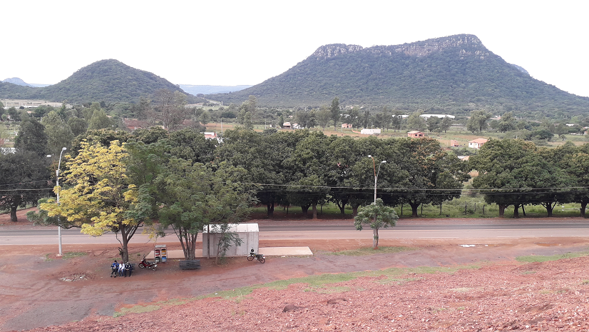
Much of Paraguay consists of a flat lowland plain. There are though to be found several areas of higher hill country. These rise sharply from the lowlands and so a visible from great distances.
These highlands are hills rather than mountains. Nowhere in Paraguay does the land rise anywhere high enough to be considered mountain scenery. They are though dramatic features in the landscape.
At times their sides may be coated with a thick covering of green trees. At others waterfalls far from great heights into the valleys below.
They stand out so clear in part as a result of the geology of the majority of Paraguay. This is a great lowland plain, an extension of the Argentine Pampus. It rises very gradually across northern Argentina and continues to do so through Paraguay up to and over the Bolivian border.
Only once the foothills of the Andes are reached does the terrain turn from horizontal to vertical.
Asuncion lies a thousand miles from sea up the River Paraguay but is little more than forty metres above sea level.
Where I live in Piribebuy is in one of these upland regions. In a thin band of hills running from the north to the south about fifty miles west of Asuncion.
Rather than looking out upon flat fields extending away to the horizon I see upland scenery of hills, rocks and valleys.
The area they cover is not vast and travel in any direction and the road soon starts to plummet downwards.
Once I am out on the paved road I can turn south and travel along the highland plateau. After not much more than five miles this plateau rises to its greatest height and then the land drops away sharply.
This is at a settlement called Km 92, after its distance from Asuncion. From here the road twists and turns as in less than a mile it drops to the lowlands below.
It is a dramatic and scenic route. On one side there is a solid rock wall several metres high. The result of the cutting made when rocks were first blasted to facilitate the laying of a road rather than a path out of the hills.
This wall of rock is over grown with trees and creepers. At many points the branches of the trees reach out to touch those on the other side of the road creating a green tunnel.
The cutting of the road severed streams that used to run down from the hills. These have now either found alternative routes along the rocks or fall over them as roadside waterfalls.
The largest of these halfway down the hill has become a popular tourist spot. It stands no more than a metre back from the paved road but still receives visitors and photographers all year round.
The other side of the road demonstrates how narrow the ledge is upon which the road is built. Beyond a scrubby verge which in places less than a metre wide the hillside drops almost vertically down to the forest covered valley far below.
In gaps between the trees the view from here extends for many miles over forests and fields.
Taking advantage of the terrain this side of the road is home to a large and established Eco-reserve. This contains in addition to its forest paths tree canopy walkways and zip lines.
After a mile the road makes a final sweeping curve and then flattens out as it heads on towards Paraguari.
Looking back the hills now appear as a solid wall of rock giving no clues as to the route taken by the path taken up into them and over the pass at the top onto the highland plateau.
If I were to head north rather than south on the paved road from my house I would again drop out of the hills and into the flatlands.
This time the distance is a little greater. The road travels north and then west before after twenty miles it passes Caacupe and descends.
The westerly road is the main east west freeway across Paraguay and so is laid out across a wider, flatter section of the plateau which just rises and falls gently.
Beyond Caacupe the road and land drop sharply towards Asuncion. The incline is a little less steep, here than in the south and so more suitable to the heavy vehicles. However it is steep enough to require the carriageways to be split and take separate downwards routes.
Being a main road the scenery is less dramatic. However there are extensive views over the lowlands below. The large inland Lake Ypacarai on which San Bernardino sits is clearly visible glistening down below.
This route comes down the side of the hills rather than over a high pass so it is a slightly longer distance before it arrives in the lowlands.
Approaching from Asuncion the hills look like a great rock wall from many miles away. The route up into them does not reveal itself until it is reached.
These are not the only hills to be found in Paraguay. A look at a map will show others. Most noticeably along the border with Brazil.
They all though stand out in the landscape and are stunning features that can be seen from far away. All coated in green and asking to be explored.
Very scenic and interesting